PROVIDING PROFESSIONAL SURVEYING SOLUTIONS
Surveying work and more. We offer professional services throughout Uruguay with precision and excellence.
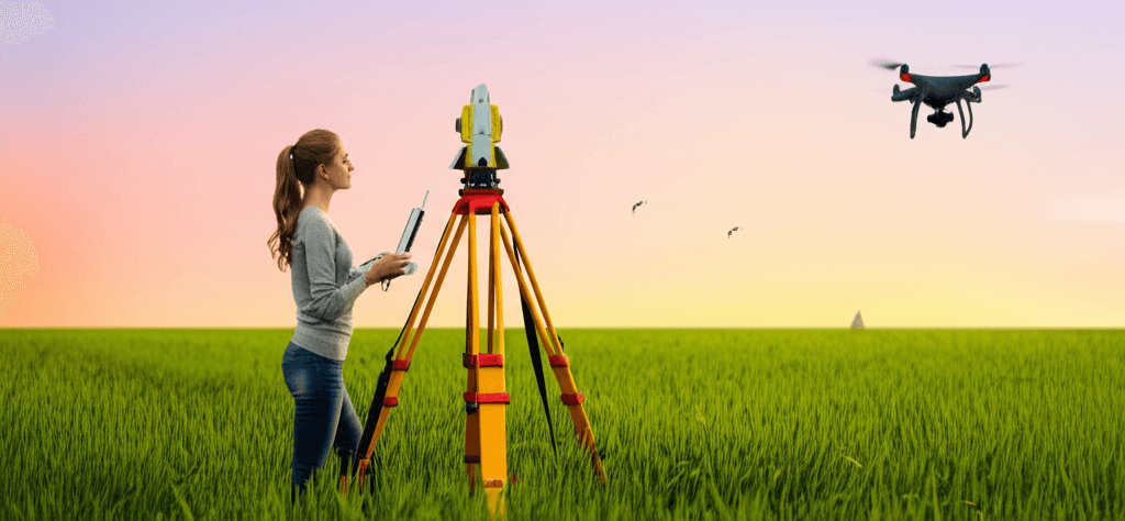
Our Services
We offer a wide range of surveying services with the highest quality and precision, using cutting-edge technology and highly qualified professionals.

+5 years
of experience in the surveying sector in Uruguay
About Us
Our commitment is to offer precise and reliable solutions for all your land measurement and delimitation needs.
Professional Team
We have a team of highly qualified professionals with extensive experience.
Advanced Technology
We use state-of-the-art equipment to guarantee the precision of our work.
National Coverage
We work throughout Uruguayan territory, providing services in any locality.
Our Work Process
We follow a structured methodology to guarantee precise and satisfactory results in each project.
We evaluate your needs and provide personalized advice.
We develop a detailed plan for your surveying project.
We carry out the necessary measurements and surveys with precision equipment.
We analyze the collected information and prepare technical documentation.
We present the results and manage the corresponding procedures.
Completed Work
Learn about some of our most outstanding projects in different areas of surveying.

Residential Subdivision
Maldonado

Topographic Survey
Montevideo

Rural Land Surveying
Rocha

Horizontal Property
Punta del Este
Our Team
Meet our experienced professionals

Antonella Garcilar
Surveying Engineer • MBA
Specialist in topography and surveying with extensive experience in urban and rural surveying projects. Masters the use of advanced technologies such as drones, precision GPS and total stations, providing comprehensive and personalized solutions to the specific needs of each client.

Lorena Gómez
Surveying Engineer
Specialist in surveys, surveys and subdivisions. Recognized for her responsibility and professionalism, she provides precise solutions adapted to the needs of each client. Her commitment and attention to detail guarantee quality results in each project.

Carlos Andrés Chiale
Systems Lic. • Cartography Technologist
Expert in Geographic Information Systems and specialized software development for the surveying sector. Combines his technical knowledge in digital cartography with advanced skills in business-level technological solution development, optimizing processes and bringing digital innovation to each project.
What our clients say
Our clients' satisfaction is our best calling card.
"Excellent professional service. The AG Agrimensura team did an impeccable job surveying my land. Highly recommended."
Carlos R.
Land owner
"I have worked with AG Agrimensura on several projects and they have always demonstrated a high level of professionalism and precision in their work."
María G.
Architect
"Their experience in subdivisions was fundamental to the success of our residential project. They met the agreed deadlines and budget."
Juan P.
Real estate developer
Frequently Asked Questions
Answers to the most common questions about our surveying services.
Contact Us
We are at your disposal to answer your questions and provide you with the information you need.